The goal of the Copernicus programme is to establish and operate a modern and efficient infrastructure for Earth observation. Since 2014, the programme has been implemented under the leadership of the European Commission in close cooperation with the Member States. Its legal basis is EU Regulation 2021/696 establishing the Union Space Programme. For national implementation, the Federal Cabinet adopted the “National Strategy for the European Copernicus Programme” in 2017. This strategy was updated in 2024 with the „National User Uptake Strategy for the Satellite Programmes Copernicus, Galileo and the Meteorological Programmes of EUMETSAT”.
European Earth Observation Programme Copernicus
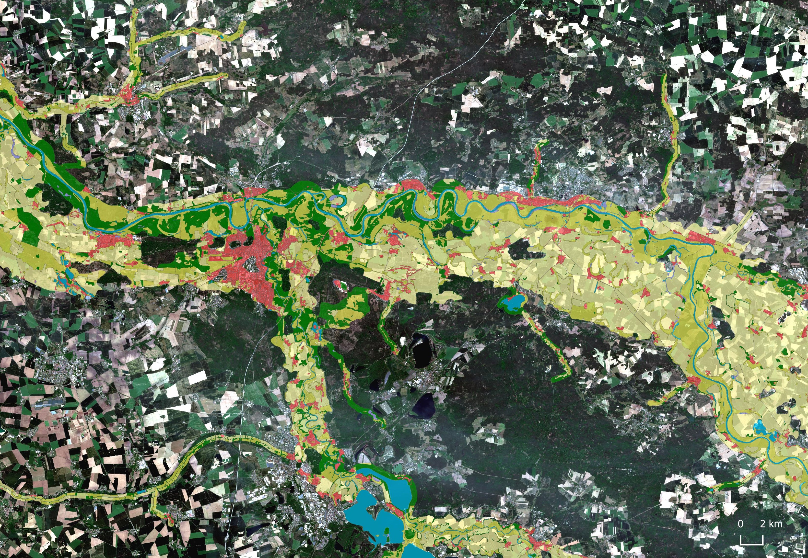
Sentinel-2 satellite image (May 21, 2020) overlaid with the “Shore Zones” data product
Source: Modified Copernicus Sentinel data (2020) and information from Copernicus services (2012)
The European Earth observation programme Copernicus provides key information for environmental and nature conservation monitoring, atmospheric and climate monitoring and crisis management in the event of natural disasters. The UBA contributes to the national coordination and supports the further development and use of Copernicus.
Table of contents
Observation systems complement each other
Satellite missions
Copernicus is structured into three components: a space component, an in-situ component, and a services component. The space component is primarily based on the Sentinel missions. These include dedicated satellites such as Sentinel-1, -2, -3, -5P and -6, as well as satellite sensors flying aboard meteorological satellites, such as Sentinel-4 and -5. The system is further complemented by the Sentinel Expansion Missions CO2M, LSTM, CRISTAL, CHIME, CIMR, and ROSE-L, which are planned to be launched gradually from the late 2020s onwards.
In addition, Sentinel Next Generation Missions are being planned to replace and expand existing capacities. The Sentinel missions are supplemented by Contributing Missions operated by the European Space Agency (ESA), its member states, the European Organisation for the Exploitation of Meteorological Satellites (EUMETSAT), and commercial providers, which deliver additional data to the Copernicus programme.
In-situ data
“In-situ” refers to measurement data collected directly on site. These data are essential for validating satellite observations and form the basis for producing high-quality data products used in the Copernicus services. The Copernicus in-situ component relies on a broad range of in-situ data collected on land, at sea, and in the air. These observations capture meteorological, oceanographic, atmospheric, and terrestrial variables and are provided through infrastructures such as weather stations, buoys, and research networks.
Services
The six Copernicus services provide a wide range of data products in the areas of land monitoring, marine environment, atmosphere, climate, disaster and crisis management, and security. These products are derived from satellite-based observations (from Copernicus and contributing missions), in combination with in-situ data, and in some cases through modelling approaches. Only the combination of these information sources enables comprehensive data collection. In general, all data products are made openly and freely available.
National Responsibilities
The responsibility for space activities in Germany lies with the Federal Ministry for Research, Technology, and Space (BMFTR), supported by the German Aerospace Center (DLR). For the Copernicus services, the federal government has appointed expert coordinators from various federal agencies. They support the government in the further development of the programme and provide information and guidance to users in Germany on Copernicus and its potential applications.
How the UBS is involved
Together with the Federal Agency for Cartography and Geodesy (BKG), the UBA is responsible for the coordination of the Copernicus Land Service. In this role, the UBA focuses on environmental protection and nature conservation. The UBA also oversees the generation of the national CORINE Land Cover dataset, a Europe-wide project aimed at providing standardized and thus comparable information on land cover and land use.
As part of the so-called “Space Networks,” the UBA acts as a “Copernicus Ambassador” and, within the framework of the National Collaboration Programme (NCP) of the European Environment Agency, helps to promote awareness of the Copernicus Land Service in Germany and to encourage wider use of its data.
The UBA is also involved in the German working group of the international “Group on Earth Observation” (GEO). GEO promotes free access to globally collected Earth observation data and connects initiatives and organizations working in this field. Furthermore, the UBA explores the potential applications of Copernicus for the environmental sector through various research projects.
Associated content
Links
Publications
- Machbarkeitsstudie zur Nutzung von Satellitenfernerkundungsdaten (Copernicus) für Zwecke der Ableitung ökologischer Belastungsgrenzen und der Verifizierung von Indikatoren der Deutschen Anpassungsstrategie an den Klimawandel
- Welchen Beitrag können Satellitenfernerkundung und insbesondere Copernicus-Daten und –Dienste für die Ermittlung ausgewählter Indikatoren des Indikatoren-Sets der Deutschen Anpassungsstrategie an den Klimawandel (DAS) leisten
- Operationalisierung von DAS-Indikatoren mit Fernerkundungsdaten (DASIF)
- Untersuchung von Potentialen zur Nutzung von Copernicus-Daten und Diensten für die Umsetzung der Hochwasserrisikomanagementrichtlinie
Related contents
Related publications
- Human Utilisation of Space – Trend Analysis of Opportunities and Risks for the Environment
- Indicators in the area of sustainable resource use and circular economy
- Review of internationally proposed critical levels for ammonia
- The upcoming European Soil Health Law – chances and challenges for an effective soil protection
- The Zero Pollution Action Plan as a chance for a cross-regulatory approach to pollution prevention and reduction