The UBA assesses whether a planned project or journey to Antarctica poses a threat to animal species or their populations. However, the current state of knowledge about whales in Antarctica is limited. UBA is therefore providing funding for projects to close these knowledge gaps.
Whales in Antarctica – What we know and what we do not know
There is still little knowledge about the abundance and distribution of whales and their populations in Antarctic waters. The existing database is very limited. Since 1978 the International Whaling Commission (IWC) has conducted three circumpolar sighting surveys to determine the size of whale populations in the Southern Ocean. These voyages covered the area between 60° South and the edge of the pack ice. Nevertheless, there is a lack of reliable estimates of stocks because the survey methods applied differed between the voyages. It remains unresolved until today whether the great differences in results of some species owe to methodology or if they are indicative of actual changes in the stock size. Furthermore, the surveys did not account for populations which are mainly found in the pack ice.
This is why the UBA has been funding a research project from 2008 – 2013 to close gap in knowledge on abundance and habitat use of whales in Antarctica. The results will provide a stronger basis for decision making in the authorisation process as foreseen in the German Act to implement the Protocol of Environmental Protection to the Antarctic Treaty (AUG). The project is also developing an neu system to detect the presence of whales. The system is aimed at reducing injury risks to whales, in particular from underwater noise.
Whale monitoring (distance sampling)
The sub-project Collection and analysis of data on occurrence, distribution and abundance of cetaceans in the Southern Ocean following international standards aims to deliver information on the occurrence abundance and habitat use of whales in Antarctica. The Institute for Terrestrial and Aquatic Wildlife Research (ITAW) of the University of Veterinary Medicine Hanover, Foundation, (TiHo) was commissioned to collect and evaluate relevant data. The internationally established method of distance sampling was applied to assess animal population densities, thereby guaranteeing reliability and data comparability. In addition, the project tracks whales to identify possible behaviour reactions to the ship.
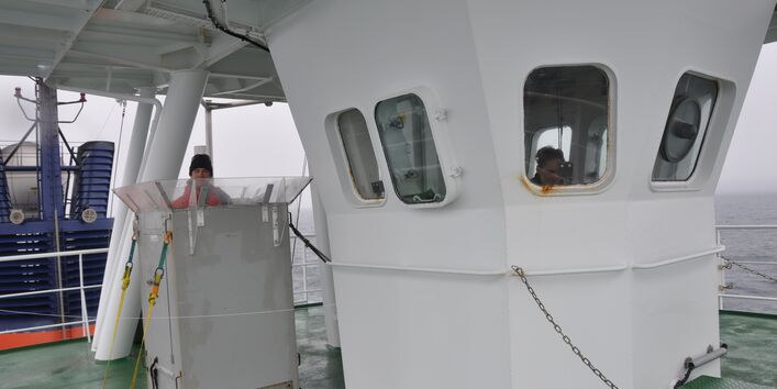
Distance sampling data was collected from two different platforms: from the crow's nest – the highest lookout point – and by the Polarstern research vessel's own helicopters. These data will determine encounter rates and population densities. Tracking method observations require excellent weather conditions (calm seas, no icebreaking), since the big eye telescopes used already impair the ability to make observations when there is slight movement of the vessel. As a result, very little tracking data has been collected. The small sample size does not yet allow establishment of a significant correlation between whale behaviour and the presence of the research vessel.
Data was collected in the 2008/2009 and 2010/2011 Antarctic seasons, covering more than 28,000 flight kilometres and 2,800 vessel kilometres. Fight surveys made 264 sightings of 724 animals; vessel surveys resulted in 105 sightings of 199 animals. A total of 14 different whale species were identified. The most frequently observed whales were humpback, fin and minke, but also included the rare blue whale and the hard-to-track beaked whale.
Model to predict whale prevalence according to suitability of habitat (Habitat Suitability Model)
The Polarstern research vessel has relied on computers to record the crew's opportunistic whale sightings from the vessel bridge since 2005. The UBA commissioned the sub-project Implementation of the whale protection monitoring agreement between the Alfred Wegener Institute and the Federal Environment Agency to the Alfred Wegener Institute (AWI). Based on this data it develops habitat models for Antarctic whales. Remote sensing data on environmental parameters such as surface temperature, water depth or chlorophyll content were used to develop models for two common baleen whales (humpback and Antarctic minke). Habitat models visualise the geographic distribution of suitable habitats on forecast maps which can be transferred to areas with no data on the occurrence of whales.
Infrared-based (IR) system to determine presence of great whales
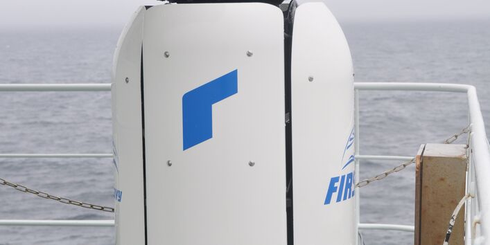
The presence of whales must be determined in due time in order to mitigate the risk of their injury (mitigation). One way to prevent injury is to turn off scientific equipment like airguns, whose noise emissions can lead to acoustic trauma in whales and seals. An infrared camera can detect the thermal signature of a whale blow, that is, the exhalation of the warm-blooded whale. A high-resolution infrared camera for detecting the presence of large whales in polar regions was further developed in the course of the AWI sub-project. Since the start of the project in 2008, this system has been used on three polar voyages made by the Polarstern research vessel. Automatic pattern recognition was further developed so that the likelihood of locating large whales at distances of up to three kilometres has greatly increased. The IR system can continuously scan the entire 360° area around the vessel for the presence of whales and operates night and day. In the medium term, the IR system could develop into a valuable mitigation support tool for human observers during both scientific and industrial use of seismic surveying. The Federal Ministry of Education and Research provided funding for the infrared camera.
The UBA’s motto, For our environment (“Für Mensch und Umwelt”), sums up our mission pretty well, we feel. In this video we give an insight into our work.
The UBA
Contact
Wörlitzer Platz 1 06844 Dessau-Roßlau GermanyPlease contact us exclusively by e-mail: buergerservice [at] uba [dot] de. Unfortunately, we are currently not available by telephone. There may currently be delays in answering enquiries. We ask for your understanding.