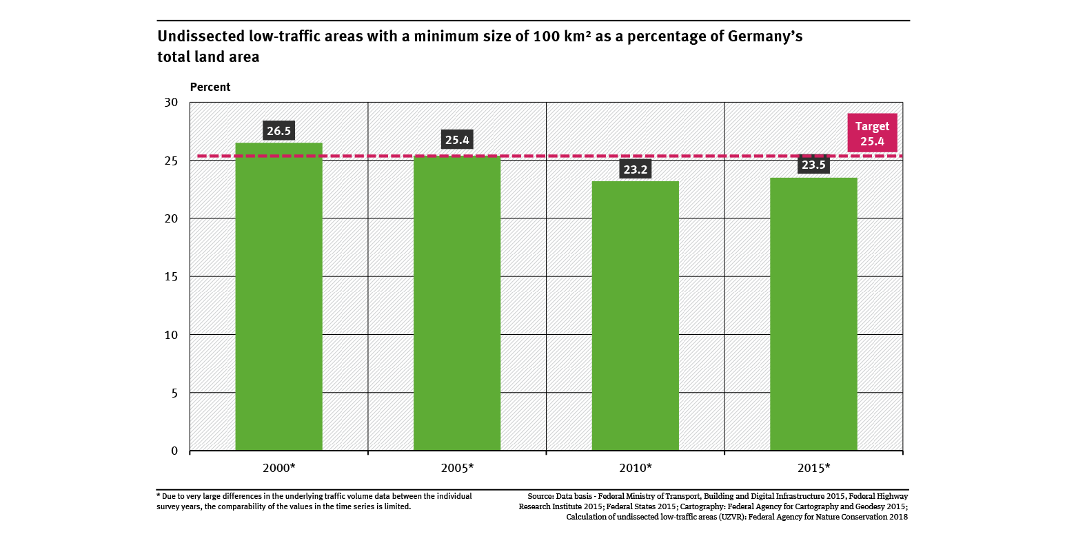
The indicator is calculated by determining the proportion of Germany's total land area which is not dissected by transport routes. Dissecting transport routes are defined as roads (motorways, national, regional and local roads) with a traffic density of 1.000 vehicles per day or above, at least double-track or electrified single-track railway lines and canals with the status of ‘federal waterway’ (Category IV or above). These areas can be identified using geo-information systems. Modelling and traffic counts (to calibrate the model) are needed to fully determine road traffic densities. The modelling approach for 2010 is described in Bosch & Partner et al. 2013, for 2015 in SSP Consult Beratende Ingenieure GmbH 2018.
The scheduled counts for the summer of 2020 could not take place due to the Covid-19 pandemic. Since spring 2021, the relevant traffic volume counts are now being conducted. This will be followed by further modeling and calculation steps. Publication is expected in 2026.
References:
Bosch & Partner et al. 2013: Bosch & Partner GmbH; University of Kassel; TCI Röhling. Ökologische Risikoeinschätzung auf Bundesebene (final report to the F+E-project 3510 82 3100 on behalf of the Federal Agency for Nature Conservation (BfN); unpublished, can be requested at BfN, in German only).
SSP Consult Beratende Ingenieure GmbH 2018: Erstellung eines bundesweiten Straßennetzes mit modelltechnisch ermittelten Verkehrsbelastungen unter Verwendung der Straßenverkehrszählungen (SVZ) 2015 als Kalibrierungsgrundlage (Expert report commissioned by the Federal Agency for Nature Conservation, in German only).